

Make planning maps that are engaging, interactive, and user-friendly
Make Plans
Make Maps
Make interactive maps easy to read with graphics and project pins
Engage Residents
Let people engage with your maps to comment about your plans
 Survey Map Citizen Engagement
Collect feedback on an interactive map
 Ideas Become Planned Projects
Crowdsource ideas, convert them to projects
 Feature Projects For Feedback
Get informed input, make better plans
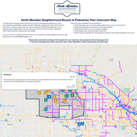
Community Remarks is used to create a bicycle and pedestrian plan
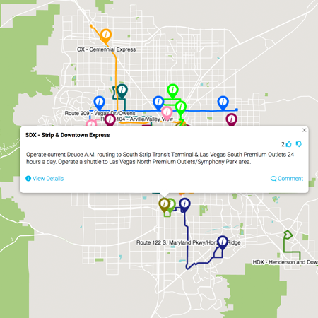
Proposed changes to bus routes enable citizens to visualize new routes
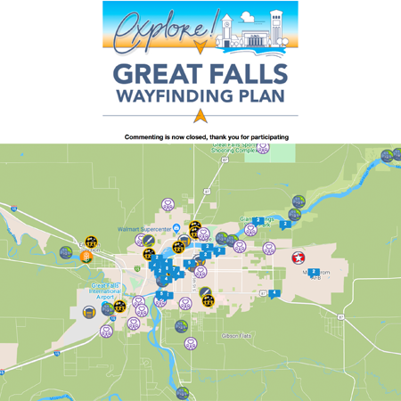
Let the public identify key locations that make their community special
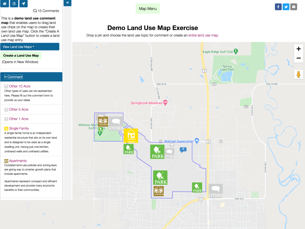
Land Use Survey
Looking for a way to solicit feedback on a land use plan? You can allow users to design their own land use map or just drop a land use chip on a location to provide an idea about a specific land use.
If you already have a land use plan, you can overlay the plan on the map and enable users to drop comments about the plan in specific locations.
Try out the demo and feel free to create a land use map on the demo.
Make impressive strides in your community engagement with interactive survey maps
Community Remarks is a survey map to collect informed, place-based comments to create a plan. Every community engagement strategy can benefit from an interactive survey map to gather feedback quickly and systematically. It is nice for those making the comments because they can see what others have said about the areas they care about. The survey form is fully customizable to collect granular data. You can have a fully functional community engagement map in hours not weeks.
Click here for a fully functional demo of Community Remarks.
Key Features
If you have an active transportation plan or a bicycle and pedestrian plan, an interactive map is imperative.
- Show funded project information
- Overlay planned improvements
- Collect feedback and votes on projects and planned improvements
- Provide information to better inform residents
- Get location-based feedback
- Spatially identify where issues exist
The Active Transportation Alliance utilized COMMUNITY REMARKS for the Brookfield, IL Active Transportation Plan. Street, sidewalk, and intersection recommendations identified during the community engagement process formed the plan to increase access to destinations.
Bannock TPO ran 2 surveys at the same time through COMMUNITY REMARKS for the Bicycle and Pedestrian Master Plan. The public was asked to identify locations in Pocatello and Chubbuck where there are issues with bicycling and walking. The second survey conducted simultaneously focused on Yellowstone corridor improvements.
Long range plans require several rounds of engagement. The first round usually collects comments around various topics. The second and third rounds present draft plan components on the map for feedback and voting.
The St. Lucie TPO Go2040 and the Polk TPO Momentum 2040 plan utilized COMMUNITY REMARKS to engage with residents who are not traditionally involved in the transportation planning process. In addition to “boots on the ground” initiatives, they relied on social media to push traffic to their map surveys. They presented needs assessment and cost feasible projects to generate a crowdsourced project ranking matrix for the final plan.
Land use can be overlaid on the COMMUNITY REMARKS map to display potential changes. Pasco County, Florida created a Future Land Use analysis exercise to encourage an open forum for dialog. Residents were asked to add comments to the map by identifying where they would like to see changes or improvements.
New Land Use Comment Map
We have developed a land use planning module for COMMUNITY REMARKS. Participants can create their own land use map by dragging land use “chips” to scale onto the map. Ideas can be filtered by land use type or user. This is an excellent way to gather feedback, illustrate constraints, and educate. Try the demo
The Genesee County Metropolitan Planning Commission utilizes COMMUNITY REMARKS for the Genesee: Our County, Our Future comprehensive plan that establishes a vision for the next 20 years. This vision is developed by analyzing land use, transportation, housing, environment, and infrastructure, along with gathering input from the public and local stakeholders.
COMMUNITY REMARKS makes it easy to manage a transportation improvement program (TIP) and solicit feedback on projects. Learn more
- Present projects on a user-friendly map and detail page
- Search by work mix, fund source, responsible agency, and description
- Collect citizen comments and votes during your commenting period
- Print projects, generate tables
Polk TPO desired to increase public participation on their TIP. They utilized the capability to collect feedback on projects. They received 96 comments during the 45-day commenting period. That was up from 60 comments the prior year. They had not received any comments on their TIP prior to making it interactive.
The COMMUNITY REMARKS platform has a module, SITEVISTA, that enables planners to create a historic preservation inventory survey from the field. The mobile-friendly admin enables photos and field observations to be geocoded on-the-fly. SITEVISTA is a template for producing a historic preservation inventory and document quickly.
The Village of Libertyville, IL conducted a Downtown survey that reflects the arc of both commercial and residential development at the core of what is now the Village of Libertyville, and includes historic resources from that span from the mid-19th century to the present day.
Over 400 landmark properties were evaluated in Evanston, IL through SITEVISTA’s powerful capabilities to georeference the surveyor’s location and capture images and architectural details from the field.
Crowdsource locations to plant trees, blighted/abandoned properties, or responses during an event. COMMUNITY REMARKS has modules to present GIS to receive direct feedback. Flood mitigation surveys can capture detailed information about needed improvements.
Web & Social
To enhance Community Remarks, PlaceVision provides additional services. We design and deploy project websites and social media campaigns to reach the largest audience possible for your project.
Engagement Strategy
We develop engagement strategies for all types of planning and development projects such as dashboards and virtual workshops. We can help with social media and e-blasts to drive traffic to your map.
Graphic Support
PlaceVision creates infographics and interactive graphics to explain and summarize plan components. We create graphs and charts by hand and dynamically. We also experiment with emerging technologies.